Iceland Ring Road Days 3-4: East and Southeast
Welcome back to our Iceland Ring Road adventure! After dodging the wicked wind storms and journeying through the remote northern Iceland, we’re now driving onward to the east and southeast regions. These areas are home to some of Iceland’s most captivating attractions, offering a blend of dramatic natural beauty and charming local culture.
In this part of the series, we’ll walk through days three and four of our trip. Get ready to discover the awe-inspiring Stuðlagil Canyon with its unique basalt columns, the quaint and colorful town of Seydisfjordur nestled in the fjords, and the enchanting sights of Diamond Beach and Jökulsárlón glacier lagoon, where shimmering icebergs create a surreal landscape.
Just like part one of the Ring Road trip, I’ll provide detailed insights on where to stop, including a downloadable map with each site and the detailed information on driving times and daily mileage. Whether you’re seeking adventure, tranquility, or stunning photo opportunities, this leg of the trip has something for everyone.
Day 3: Stuðlagil Canyon, Seydisfjordur & Stokksnes
Since we had showered late the night before, we opted to hit the road early, so I can’t say whether or not the facilities were good at Vogar tjaldsvæði. As we left the campsite, we were hit with a bit of a traffic jam as a huge flock of sheep were being herded across the road. It was so cool to see a Réttir in progress.
Today our big plan was Stuðlagil Canyon. I saw this on a few blogs while researching the trip and was in awe of the basalt columns. Out of the all of the items on our itinerary, this one was absolutely a must. Once again, this site is a little off the Ring Road on a narrow dirt path, which felt even more treacherous with the extreme wind. I’m glad Mark was driving because my morning cup of coffee was sending me into anxiety mode.
When you visit Stuðlagil, you can park on either side of the river. The GPS routed us to the side that you can just see the canyon from an overlook. We saw a bunch of people on the other side hiking, so we decided we would double back, park, and hike so that we could get better pictures. While I didn’t love our little detour, it did give us an opportunity to use the WC since the one on the other side of the river ended up being out of order. If you want to go straight to the hiking side (recommended), you need to park on the west side of the river by routing to this parking lot. I loved this stop, even if we didn’t have the best lighting for pictures. It was so unique.
Next stop was Seydisfjordur, a town on the coast of the East Fjords most known for its rainbow-colored main street. Seriously, if you Google Iceland, a picture of this street is going to come up. This town is super small and there isn’t much else going on in it. Mark much more enjoyed the drive to the town than the actual town itself. I’m not sure why, but when we navigated to Seydisfjordur, Google took us down 95 South instead of staying on Route 1. The views along this route were absolutely epic; we pulled over several times to take photos.
Now that we were closer to the coast again, the wind was getting stronger, which I didn’t even know was possible. My revised itinerary had us ending with Stokksnes and then driving further down the Ring Road to get us halfway to Vik. The wind was so strong while we were driving that it literally felt like our camper was being lifted off the road. Mark begged me to find a closer campsite so we could get off the road and settle for the night sooner rather than later.
I discovered there was camping at Stokksnes, and it was actually the old set for The Witcher TV series! The campsite was called Vestrahorn and it included free admittance to Viking Village with dramatic views of Stokksnes. Since it was so windy, we decided to get up early and use our ticket the next morning. Hermie rocked so hard all through the night that I actually Googled what wind speed was required to knock over a camper truck (around 45 mph). I had trouble falling asleep knowing that the gusts outside were hitting up to 55 mph. Since sleep was questionable at best, we were able to see the Northern Lights! They were very faint from our viewpoint, but we saw them! We weren’t expecting to see lights since it was a little early in the season for them, so it was a nice treat.
Day 4: Diamond Beach, Jökulsárlón, Svartifoss & Fjaðrárgljúfur
It was still fairly windy when we woke up the next morning, but better than the night before so we continued on with our plan to check out the Viking Village and Stokksnes. There was a bit of a traffic jam at the showers since there were only two available for all of the campers, but we were soon driving out to the Stokksnes viewpoint. Snapping pictures along our walk to the Viking Village, we saw an animal running along the flats—a reindeer! Immediately we were thankful for the delay at the showers since it meant we got to see another Icelandic animal. Mark was thankful that he had upgraded his camera equipment before the trip because even though we were far away, he was able to capture the reindeer running next to the ocean with an extender on his 100-400mm lens.
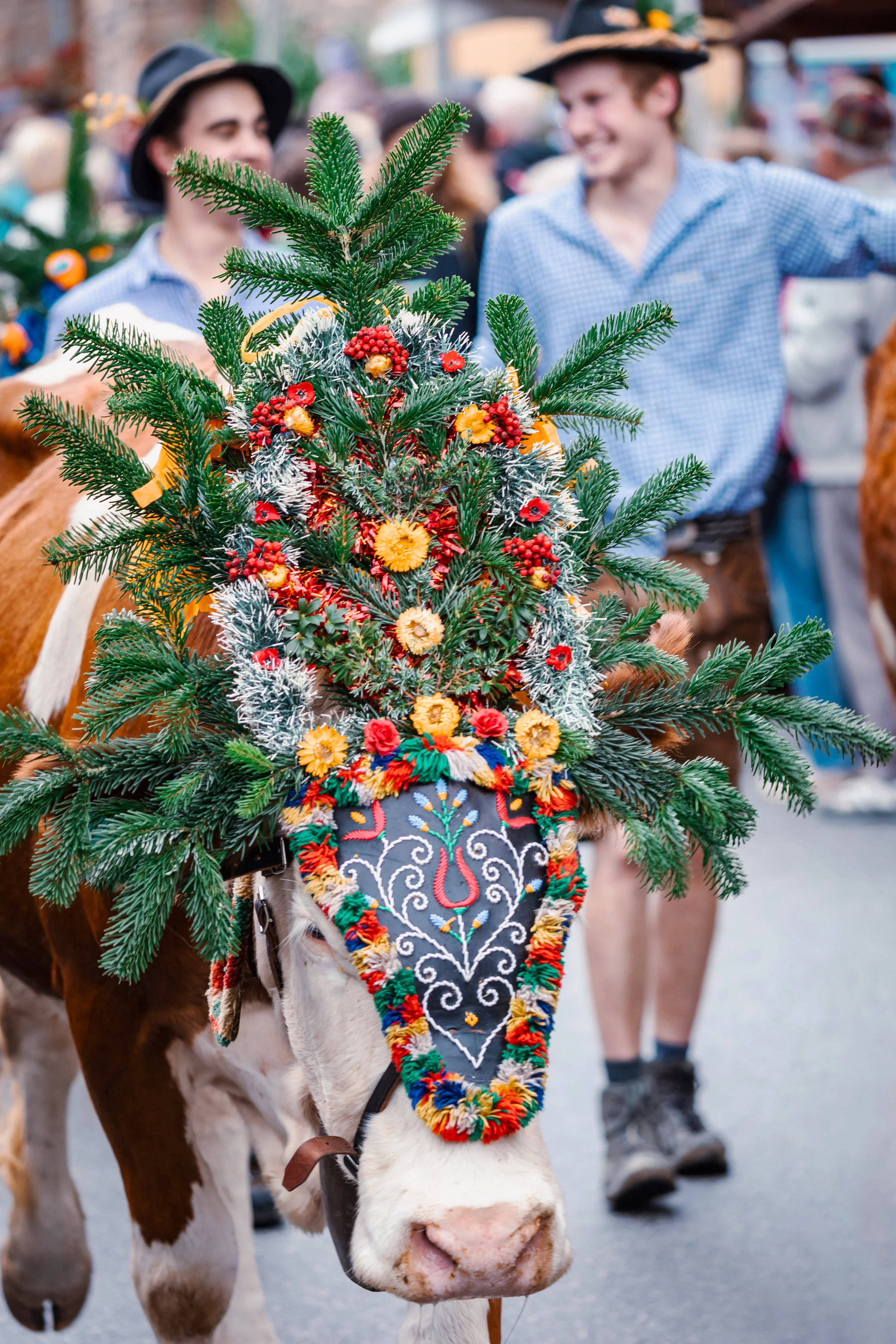
There were also some grazing Icelandic horses near the village, so we took pictures of them too. Not only are Icelandic horses smaller than average and extra furry to survive the cold, rainy weather, they are also special because they are the only horse breed that can perform five different gaits. Most horses walk, trot, canter and gallop, but Icelandic horses also tölt and flugskeið. The tölt is the human equivalent of speed-walking and flugskeið is known as the “flying pace,” hitting up to 31 mph. One of my goals on the trip was to get incredible pictures of the animals, much like we had earlier in the summer for the alpine cows in the Dolomites.
Back on the road, we were nearing the part of the trip that I was most looking forward to—the South Coast. As I mentioned above, most of the key sights are located in the south of Iceland. After almost a full week battling the winds, it looked like our gamble had paid off. The closer we got to Vik, the more the winds seemed to taper off.
Our first stop in the south was the famous Diamond Beach and Jökulsárlón, a glacial lake that shares a parking lot with Diamond Beach. We opted to park on the Diamond Beach side since the parking lot was bigger and there was a path to walk between the two sides. We cooked a quick lunch in Hermie and then explored both sides. The weather was so warm and wind-free that for the first time in five days, we didn’t need a coat! The sun was shining and we watched the seals go out to sea, riding the current from Jökulsárlón into the ocean. Another bright spot about this stop was they had a free water filling station and it was some of the cleanest, freshest water I’ve ever tasted. Some of the other places we had filled up on water, especially up north, had a faint sulfuric smell to it. The water was absolutely safe, just a little funky.
Now that we were in the south, all of the sites we wanted to see were much closer to each other, so it felt like we were able to see and do more during the day with a lot less driving. Since I was so intrigued by the basalt columns in Stuðlagil, I knew we would have to take a slight detour off the Ring Road to see Svartifoss, a 65-foot-tall waterfall that flows over basalt columns on either side.
Something I hadn’t realized about Iceland prior to visiting was how much driving it actually is. It reminded me a lot of our trip to Yellowstone where it seemed like we were mainly driving from site to site without a lot of hiking or walking. So it was a welcomed relief that we would have a little bit of a hike to get to Svartifoss. From the parking lot, it takes about 45 minutes to reach the falls. With little to no wind and bright sunshine, we actually broke a little bit of a sweat climbing to the falls! There are a ton of hikes and camping available in this area and it would have been so fun to spend a few days here going on longer hikes.
As it grew nearer to golden hour, we hopped back into Hermie and started toward our final stop for for the day, Fjaðrárgljúfur. Out of everything we saw in Iceland, this was probably my favorite. The canyon surrounded by the lush green grass and lit by pink sherbet skies felt out of this world. It felt like something that someone painted on a canvas, but here it was, existing in real life right before our eyes.
From Fjaðrárgljúfur, we decided to camp in Vik since there weren’t a lot of other options nearby, and I had found a black crust pizza place that both of us were dreaming about after having so many camping meals in Hermie. The campsite in Vik was one of the largest we had stayed at so far in the trip, and I can see how in the summer it would be an absolute madhouse. Since we were officially in the shoulder season, we had zero issue finding a space with electricity. As for the pizza, it ended up being everything we wanted and more.
Route Map
This map shows the full route of our 8-day Iceland Ring Road adventure. This post focused on days three and four of the trip in the East and Southeast region, including Stuðlagil Canyon and Diamond Beach. Download the full interactive map for more details:
Itinerary with Driving Distances
DAY 3: Northeast Region
START: Vogar tjaldsvæði
STOP 1: Stuðlagil Canyon (132 km from Vogar tjaldsvæði)
STOP 2: Seydisfjordur (98 km from Stuðlagil)
END: Vestrahorn (273 km from Seydisfjordur)
Total distance for the day: 503 km
DAY 4: Southeast region
START: Vestrahorn
STOP 1: Diamond Beach & Jökulsárlón (74 km from Vestrahorn)
STOP 2: Svartifoss (57 km from Diamond Beach)
STOP 3: Fjaðrárgljúfur Canyon (78 km from Svartifoss)
END: Vik camping (68 km from Fjaðrárgljúfur)
Total distance for the day: 277 km
Next up: Day 5 & 6: onward to Southern & The Golden Circle Iceland
As we conclude our exploration of Iceland's eastern and southeastern regions, we've uncovered some of the country's most captivating attractions, from the beautiful basalt columns of Stuðlagil Canyon to the Instagram-worthy rainbow road of Seydisfjordur, and the enchanting sights of Diamond Beach and Jökulsárlón glacier lagoon. Each stop has offered its own unique beauty, adding to the unforgettable memories of our time in Iceland.
But there's still so much more to see! In the next part of our series, we'll arrive at the southern coast and the famed Golden Circle. Get ready to go puffin chasing in Vik, dip into some more thermal baths, and see the geothermal wonders of Geysir and Kerid Crater.
Related posts
Part 1: Starting Iceland’s Ring Road: West and North Region
Part 3: Iceland Ring Road Days 5-8: South, Golden Circle and Reykjavik


Looking back on 2025, the year brought international moves, marathon miles, career changes, and the slow process of finding balance again. Read on for a candid year-in-review reflecting on relocation, burnout, resilience, and coming home.